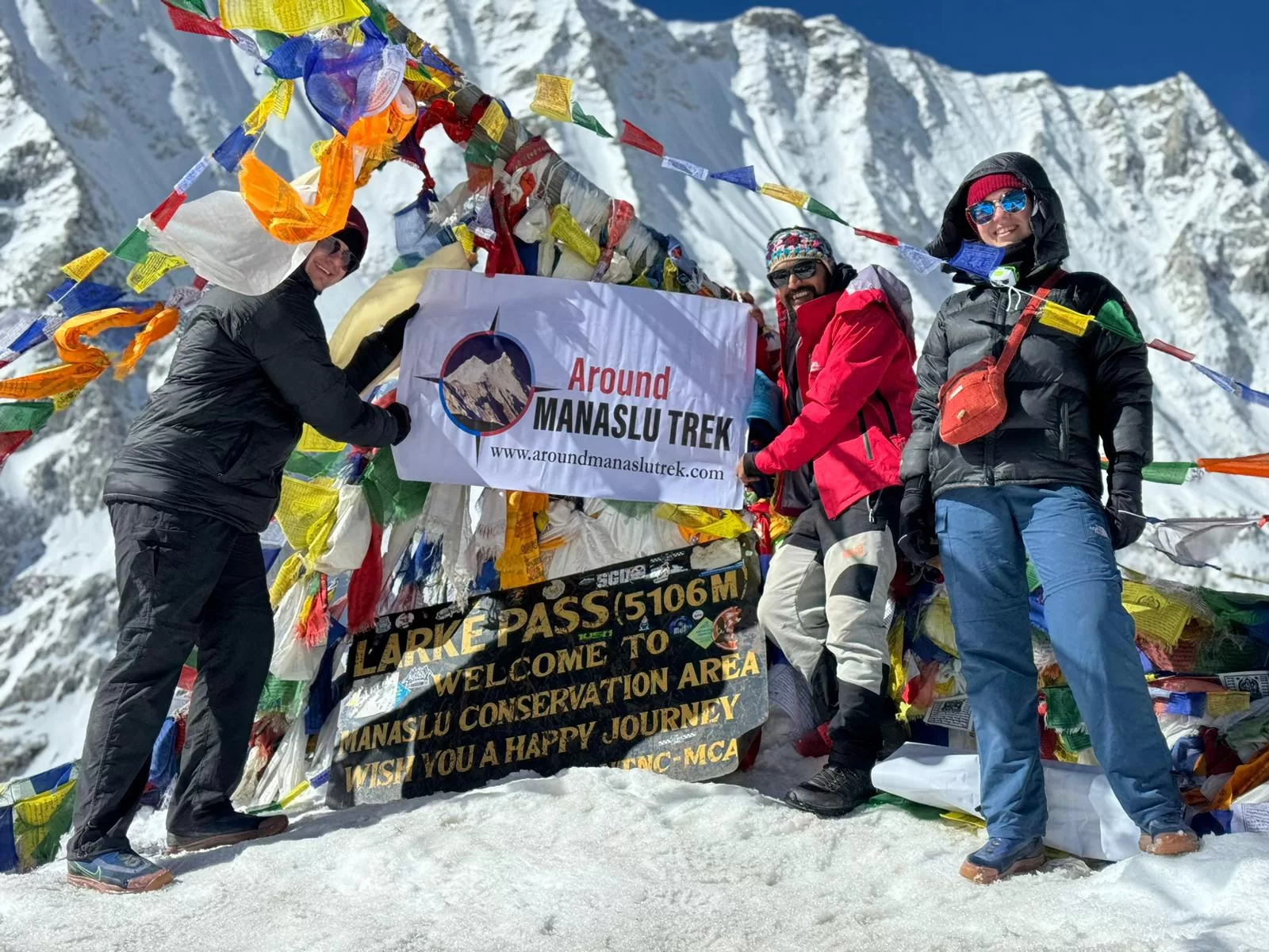
The Manaslu Circuit Trek is one of the best teahouse trails in Nepal; it stands out for its unique blend of culture, with a strong influence of Buddhism, and its picturesque teahouse trail. It is an off-the-beaten-path trek, circles the majestic Mount Manaslu crossing the challenging Larkya La Pass at an altitude of 5,106 meters, provides stunning views, diverse landscapes, and cultural insights. The Manaslu Circuit Trek ranks among the most captivating and sought-after trekking routes in Nepal, trailing closely behind the Everest Base Camp and Annapurna Base Camp treks in popularity. Our experienced local guides have been leading affordable Manaslu Circuit treks for over a decade.
Manaslu is a popular remote area located in the central northern part of the Himalayas in Nepal. It reckons in the sub-tropical Himalayan foothill to dried Trans-Himalaya high meadow bordering Tibet, China. The elevation of its sub-tropical zone varies from 1000 meters to 2000 meters; whereas the sub-alpine zone ranges from 3000 meters to 4000 meters. Its zone above 4500 meters is called an arctic zone.
Historical Access Restrictions: The Manaslu region was closed to foreigners until 1991. Although it is now a popular tea-house trekking route, certain areas remain restricted or controlled zones, requiring special permits for foreign visitors.
Thrilling Adventure at Larkya La Pass
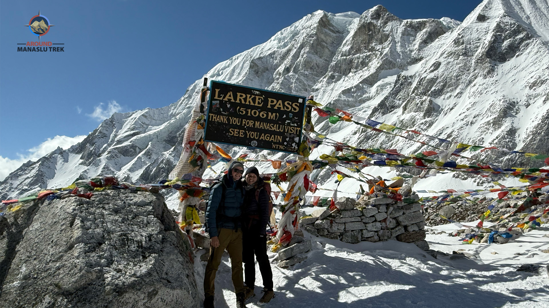
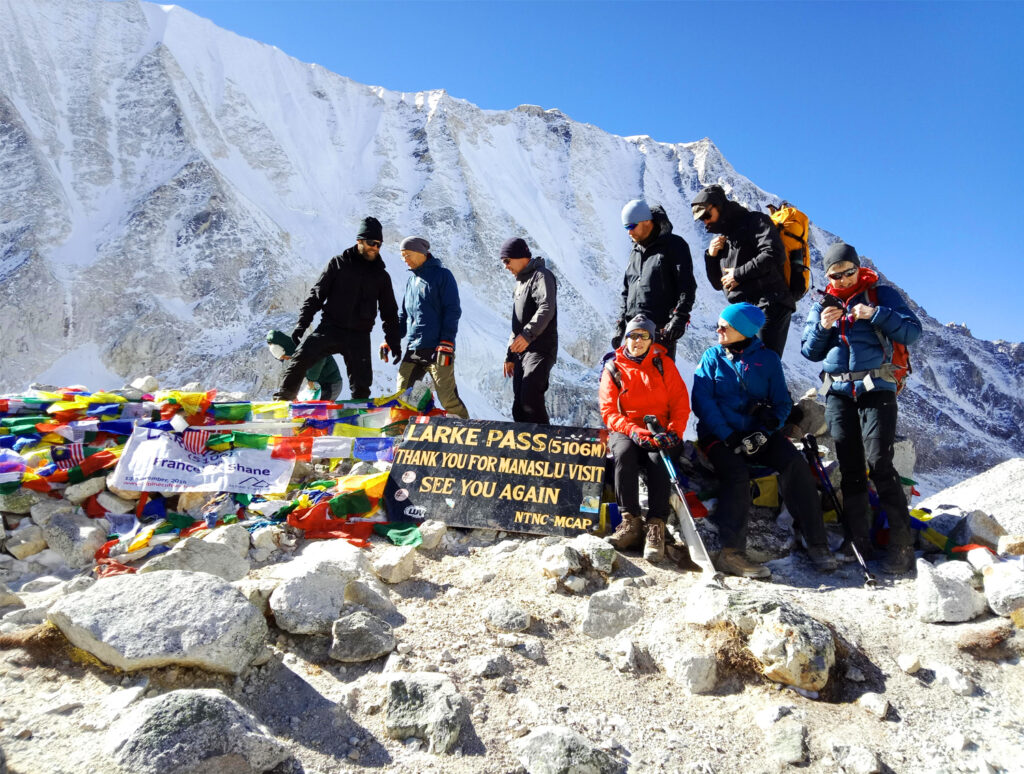
Throughout the Manaslu Circuit Trek, Larkya La Pass at 5,106 meters stands out as the most challenging and thrilling high pass in Nepal’s Himalayas. At its summit, trekkers are treated to breathtaking views of Manaslu, Manaslu North, Samdo Peak, Naike Peak, Larkya Peak, and Cheo Himal. The pass lies between Dharmasala and Bimtang, marking the highest point of the trek. In winter, heavy snowfall can make crossing Larkya La Pass difficult, often blocking the trail near the summit.
We, the Around Manaslu Trek, with our local crew and experienced team, specializes in leading treks throughout the Himalayas. Offering various multi-package treks in the Manaslu region for 2026 and 2027, we customize trek itineraries based on preferences and holiday duration. With licensed local guides from the Manaslu region, our high success rate ensures safety and enjoyment, even under challenging conditions. This restricted trekking journey promises unparalleled scenery, including the majestic Mt. Manaslu (8,163m), the world’s eighth highest peak, making it an ideal choice for those seeking tranquility, wilderness, and cultural immersion amidst Nepal’s rural landscapes.
Mount Manaslu: Nepal’s Eighth Highest Peak
Mount Manaslu, located on the border between Nepal’s Gorkha and Manang districts, stands 64 km east of Annapurna. This majestic peak, named after the Sanskrit word “Manasa” meaning “Mountain of the Spirit,” reaches a height of 8,163 meters. It is one of the world’s 14 peaks over 8,000 meters, with Manaslu being notable for its historical significance in mountaineering.
Historical Significance and First Ascent of Mount Manaslu
Mount Manaslu was first summited by a Japanese expedition Team in 1956 led by Toshio Imanishi and Gyaltsen Norbu Sherpa. The early climbing attempts began with the Japanese Manaslu Reconnaissance Expedition in 1952, which explored the mountain when it was still unclimbed. In 1953, a climbing team reached 7,750 meters but had to turn back.
The 1954 expedition faced resistance from the local inhabitants of Samu village, who believed the mountain was sacred and would bring misfortune. This led the climbers to redirect their efforts towards Ganesh Himal. After diplomatic efforts by the Nepalese government, the 1956 Japanese expedition, led by the experienced Yuko Maki and including climbers such as Katsuro Ohara and Toshio Imanishi, successfully reached the summit. This team made history by being the first Asian expedition to summit an eight-thousander.
On May 9, 1956, Imanishi and Gyaltsen reached the summit, offering breathtaking views of Ganesh Himal, Annapurna, Dhaulagiri, and Machhapuchhare. Two days later, Kato and Higeta followed suit. The first Nepali national to climb Mount Manaslu was Urkien Tshering Sherpa, who reached the peak on April 22, 1973.
Manaslu Circuit Trek Route
The renowned Manaslu Trek route circumnavigates the Manaslu massif, crossing high passes and descending towards Annapurna. This trek follows the historic salt-trade route along the Budhi Gandaki River, providing a scenic and culturally rich adventure.
Trip Facts
| Starts from | Machha Khola | Ends at: | Dharapani |
| Trek Region: | Manaslu Region | Duration: | 15 Days |
| Trip Grade: | Moderate | Max Altitude: | 5106m |
| Accommodation: | Teahouse | Meals: | Breakfast, Lunch and Dinner |
| Best season: | March to May and September to November |
Manaslu Circuit Trek Highlights
- Stunning Mountain Views: The trek provides awe-inspiring views of Mt. Manaslu, the eighth highest mountain in the world, along with other towering peaks like Himalchuli, Ganesh Himal, and others.
- Rich Cultural Experience: Encounter diverse ethnic communities such as the Gurungs, Nubri, Tsum, and Bhutias, each with their own distinct traditions, architecture, and way of life. Explore ancient monasteries, chortens, and prayer flags that dot the landscape.
- Tsum Valley: Visit the secluded Tsum Valley, known for its ancient Buddhist monasteries, pristine landscapes, and the warm hospitality of its inhabitants.
- Larkya La Pass: Challenge yourself with a crossing of the Larkya La Pass at 5,106 meters, offering breathtaking panoramic views of the surrounding peaks and valleys.
- Tea House Experience: Enjoy the unique opportunity to stay in traditional teahouses along the trail, offering a glimpse into the local way of life.
- Off-the-Beaten-Path: Experience the tranquility of a less crowded trekking route compared to other popular treks in Nepal, providing a sense of solitude and adventure.
- Natural Beauty: Immerse yourself in the stunning landscapes of the Manaslu region, including lush forests, terraced fields, and pristine rivers and waterfalls.
- Wildlife: Spot various wildlife species such as the elusive snow leopard, Himalayan tahr, blue sheep, and a variety of bird species in the region’s conservation areas.
Why to trek Manaslu Circuit
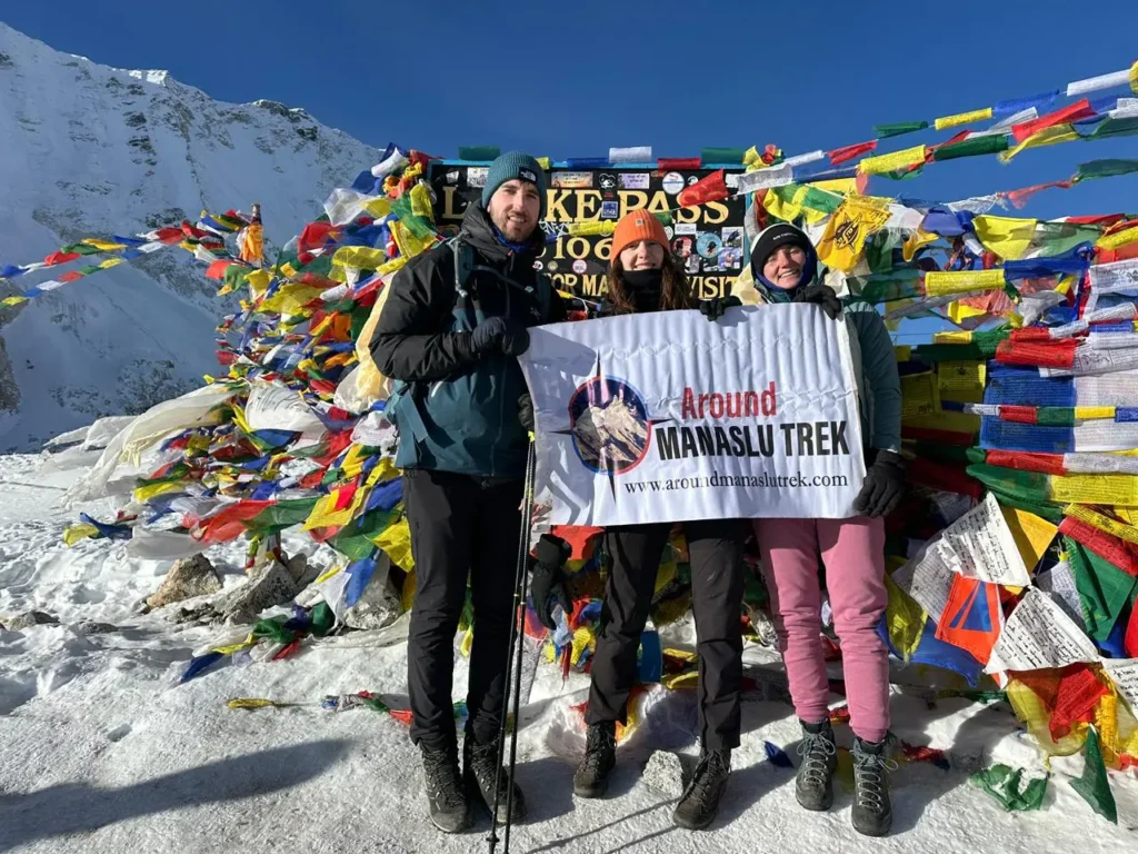
The Manaslu Circuit Trek offers a wealth of experiences and surpasses other trekking regions in Nepal with its diverse elements. Key features include:
- Cultural Richness: The trek showcases Buddhist culture, enriched by the presence of the Nubri, Tsum, Bhutia, and Gurung ethnic groups, who have resided in the region for over 700 years. Their culture closely resembles Tibetan culture. The region is dotted with significant Buddhist sites like Pungen Gompa, Mu Gompa, and Syala Gompa.
- Natural Wonders: The trek passes through diverse wildlife habitats, verdant forests, and across raging rivers via suspension bridges, all set against the backdrop of a breathtaking necklace of mountains.
- Manaslu Conservation Area: Covering 1663 square kilometers, this area was declared a conservation area in 1998. It is home to:
- Endangered species such as red pandas, snow leopards, Himalayan tahr, Asian black bears, Himalayan musk deer, and blue sheep.
- More than 110 bird species, 35 mammals, and 3 reptiles.
- The Himalayan honey bee (Apis laboriosa), known for producing Mad Honey and being the world’s largest honey bee.
A Rare and Unforgettable Moment in the Manaslu Wilderness
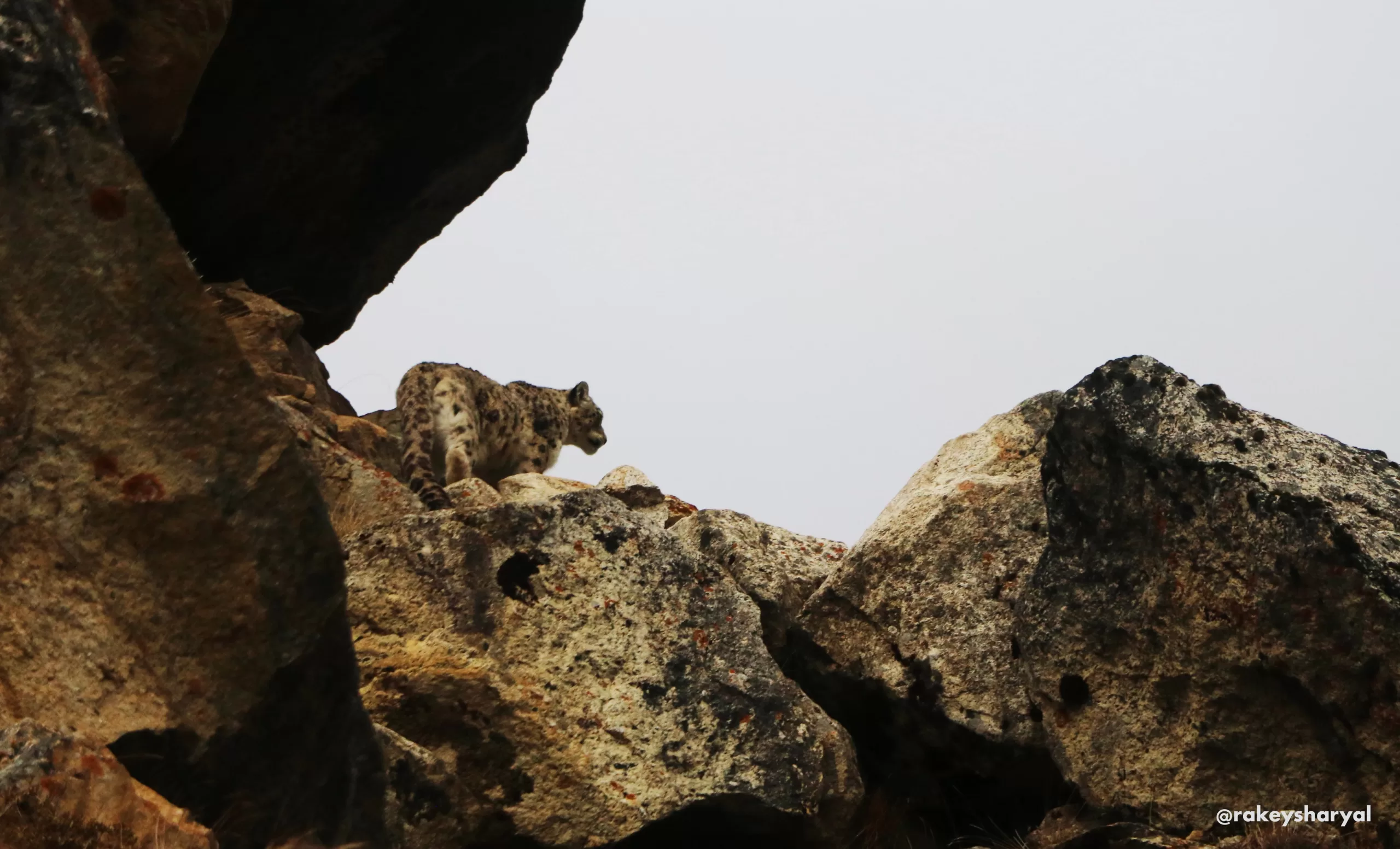
In May 2025, our trekking team experienced one of the most extraordinary wildlife encounters imaginable in the Himalayas. While hiking along the rugged trails of the Manaslu Circuit, one of our lucky trekkers spotted — and captured on camera — the elusive snow leopard.
This majestic predator, often called the “Ghost of the Mountains,” is rarely seen even by seasoned guides who have spent decades in the region. The sighting was a testament to the untouched beauty and rich biodiversity of the Manaslu Conservation Area, where snow leopards roam freely among pristine alpine landscapes.
While no wildlife encounter can be guaranteed, the mere possibility of crossing paths with such a rare creature adds a thrilling layer of anticipation to your trek. It’s moments like these — raw, unplanned, and deeply humbling — that make the Manaslu Circuit one of the world’s most unforgettable trekking adventures.
Benefits of the Manaslu Circuit Trek We Offer
- Reconnect with Nature in Just 15 Days
Escape the noise of daily life and immerse yourself in the raw, healing energy of the Himalayas. - Experience Authentic Mountain Culture
Discover the rich Tibetan-influenced traditions, ancient monasteries, and warm hospitality of the mountain communities. - Embrace Natural Beauty and Tranquility
Trek through serene landscapes filled with snow-capped peaks, raging rivers, lush forests, and peaceful trails—an ideal way to unwind and recharge. - Guided by Locals, Travel Responsibly
Our experienced native guides offer deep knowledge of the region, while we remain committed to eco-friendly practices that support local communities and preserve nature.
Outline Itinerary
| Days | Day-to-Day Itinerary | Elevation in meter | Trekking hour per day |
| 1 | Arrival in Kathmandu airport and transfer to hotel | 1350m | |
| 2 | Trek Preparation Day and Half Day sightseeing Kathmandu Valley | 1350m | 4 hours tour |
| 3 | Kathmandu to Machha Khola | 870 m | 7 – 8 hours drive |
| 4 | Machha Khola to Jagat | 1340 m | 5 – 6 hours trek |
| 5 | Jagat to Deng | 1805 m | 6 – 7 hours trek |
| 6 | Deng to Namrung | 2630 m | 7 – 8 hours trek |
| 7 | Namrung to Samagaon | 3,530 m | 6 – 7 hours trek |
| 8 | Rest day in Samagaon and a side trip to Manaslu Base Camp | 3530 m | |
| 9 | Samagaon to Samdo | 3875 m | 4 – 5 hours trek |
| 10 | Acclimatization day at Samdo and visit to Tibetan border | 4800 m | |
| 11 | Samdo to Dharmasala | 4460 m | 4 – 5 hours trek |
| 12 | Dharmasala to Bimtang via Larkya La (5106 m) | 3590 m | 8 – 10 hours trek |
| 13 | Bimtang to Dharapani | 1860 m | 5 – 6 hours trek |
| 14 | Dharapani to Kathmandu | 1350 m | 7-8 hours drive |
| 15 | Final Departure / drop off to airport |
Detailed Itinerary of Manaslu Circuit Trek
Day 01Arrival in Kathmandu and Transfer to the Hotel
Upon your arrival at Tribhuvan International Airport (TIA) in Kathmandu, our representative will be there to greet you personally and escort you to your hotel. This seamless airport transfer is a complimentary service we provide to all our valued guests.
Day 02 Trek preparation day and half day sightseeing in Kathmandu Valley
Today is a mix of getting ready for your adventure and soaking in a bit of Kathmandu’s charm. You will start your morning by organizing everything for the trek—double-check your gear, ensure your permits are sorted, and have a quick chat with your guide to go over the plan.
Once that’s done, take some time to explore the vibrant culture of the Kathmandu Valley. Visit iconic landmarks like Swayambhunath Stupa (Monkey Temple) for its stunning views and spiritual ambiance or head to Pashupatinath Temple to experience its profound cultural significance. Sightseeing around the Kathmandu Valley is an optional add-on that we are happy to arrange for you upon request.
Use the rest of the day to relax, soak in the city’s atmosphere, and prepare for the journey ahead.
Day 03 Drive from Kathmandu to Machha Khola (870 m / 2,362 feet)
Our journey begins with a scenic drive from Kathmandu, winding through lush green landscapes and terraced hillsides that characterize Nepal’s beautiful hill region. We’ll follow the Trishuli River’s banks, enjoying glimpses of traditional villages, riverside views, and glimpses of mountain vistas in the distance. As we pass Benighat, we enter rural Nepal, driving toward the charming town of Aarughat and onward to Soti Khola. The final stretch takes us along a rugged road to Machha Khola, our destination for the night. It’s a full-day drive, filled with diverse landscapes and a perfect introduction to the adventure ahead.
Drive from Kathmandu to Machha Khola: Highlights & Estimated Timings
- 6:00 AM – Departure from Kathmandu: Begin your journey in the early morning, leaving the lively streets of Kathmandu as the city slowly awakens. The crisp morning air sets the tone for a scenic and memorable drive.
- 9:00 AM – Riverside Drive Along the Trishuli: Enjoy a serene drive alongside the Trishuli River, where lush hillsides and peaceful riverside views offer a beautiful backdrop for the journey. The winding road reveals Nepal’s stunning countryside at every turn.
- 11:30 AM – Lunch Stop at Dhading Besi: Pause for lunch in the bustling town of Dhading Besi. Take the opportunity to sample local dishes and immerse yourself in the flavors and lively atmosphere of this vibrant town.
- 2:30 PM – Passing Through Arughat Bazaar: Continue on to Arughat Bazaar, a lively trading post filled with local vendors, markets, and a glimpse into daily life in the hills. The vibrant scene here is a fascinating part of the journey.
- 5:00 PM – Arrival at Machha Khola: Arrive at the tranquil village of Machha Khola, set alongside the Budi Gandaki River. The peaceful surroundings mark the end of the day’s journey, offering a perfect spot to relax and prepare for the trek ahead.
Meals: Lunch and Dinner
Accommodation: Teahouse
Drive: 8 hours
Distance: 160 km approx.
Transportation Options
For the Manaslu trek, we usually arrange travel by local bus as it is the more affordable option. However, if you prefer extra comfort and flexibility, a private jeep is also available.
- Local Bus: Budget-friendly but less convenient. You’ll need to be at our office or the bus park by around 6:00 AM for departure. The bus makes a few stops along the way for lunch and short breaks, but it can be less flexible and not as comfortable as a jeep.
- Private Jeep: Costs about USD 240 for the drive from Kathmandu to Machha Khola. While more expensive, a jeep allows you to travel at your own pace, can make extra stops for photography, and enjoy a more relaxed and pleasant journey.
Note: Timings are approximate and may vary due to road and traffic conditions.
Day 04 Machha Khola (870m) → Jagat (1,340m / 4,494ft)
- Starting Point: Machha Khola (870m)
- Ending Point: Jagat (1,340m)
- Trek Duration: 6–7 hours
- Distance: 22 km (13.7 miles) approx.
- Altitude Gain/Loss: +470m
- Accommodation: Teahouse
- Meals: Breakfast, Lunch, Dinner
Route Highlights: Gurung village of Khorla Besi, natural hot springs at Tatopani, Budhi Gandaki River valley, Dobhan (confluence of two rivers), cantilever suspension bridge near Gheru.
Special Experiences: Relaxing in Tatopani’s hot springs, crossing dramatic suspension bridges, cultural encounters in Gurung villages, scenic photography along the Budhi Gandaki gorge.
Challenges/Notes: Some sections pass through landslide-prone terrain — listen to your guide’s instructions carefully. Expect a mix of uphill and downhill walking with exposed trails.
Itinerary Description:
Leaving Machha Khola, the trail gradually leads you through charming settlements along the Budhi Gandaki River valley. You’ll pass through Khorla Besi, a traditional Gurung village where trekkers can witness authentic Himalayan lifestyle. A refreshing stop awaits at Tatopani, famous for its natural hot springs — the perfect place to rest and soothe tired muscles.
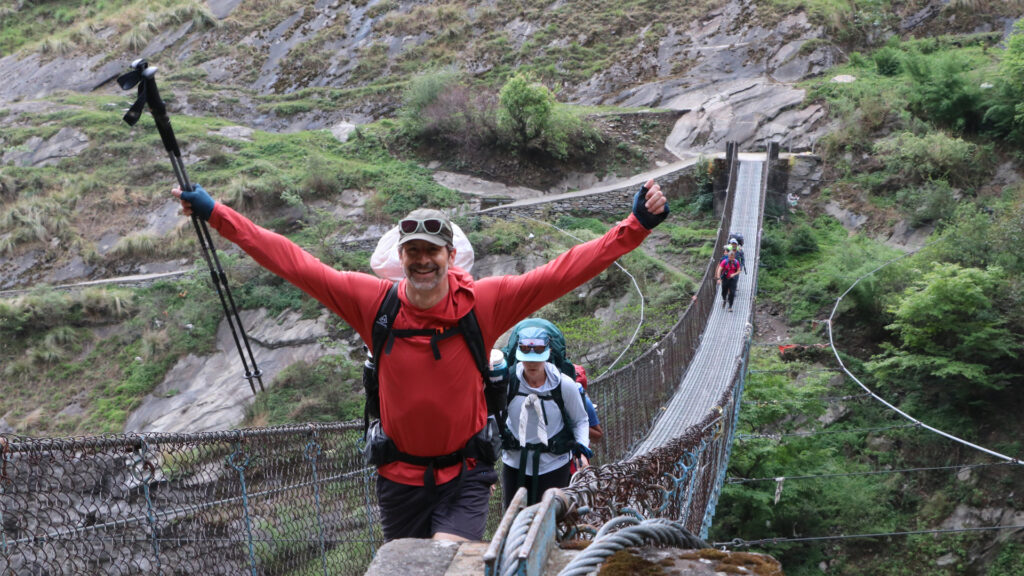
The trek continues along the right bank of the Budhi Gandaki, crossing suspension bridges and enjoying spectacular views of the surrounding cliffs and river. As you approach Dobhan, meaning “confluence of two rivers” in Nepali, the landscapes grow more dramatic, shaped by landslides. Finally, after crossing a cantilever suspension bridge near Gheru village, you’ll reach Jagat, a welcoming Gurung settlement and the official permit checkpoint for the restricted Manaslu region.
Overnight Stay: Jagat
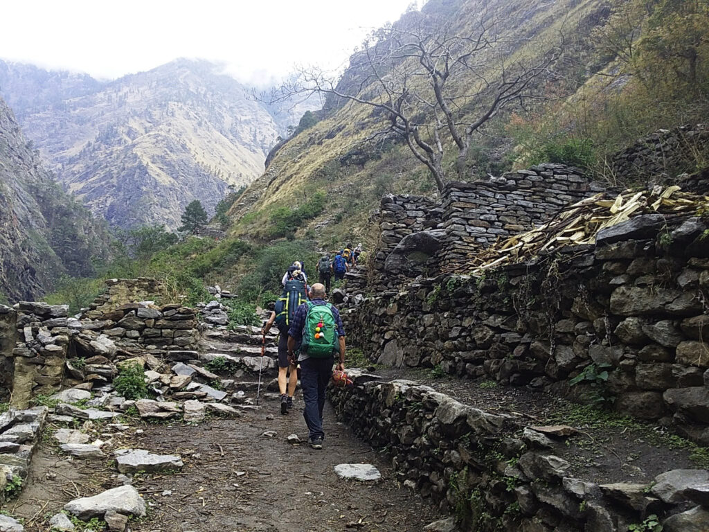
Day 05 Jagat (1,340m) → Deng (1,804m / 5,920ft)
- Starting Point: Jagat (1,340m)
- Ending Point: Deng (1804m)
- Trek Duration: 7-8 hours
- Distance: 22 km (13.6 miles)
- Altitude Gain/Loss: +464m
- Accommodation: Teahouse
- Meals: Breakfast, Lunch, Dinner
Route Highlights:
- Villages of Salleri and Sirdibas
- Ghatte Khola River valley
- Numerous prayer flags and gompas along the trail
- Philim, the largest Gurung village in the region
- Chisapani village
- Bamboo forests, millet fields, and Budhi Gandaki River crossings
Special Experiences:
- Cultural encounters in Philim, including schools, hospitals, and local monasteries
- Optional taste of local alcohol at stop points along the trail
- Scenic views of rhododendron forests, hanging cliffs, and Himalayan peaks
- Crossing long suspension bridges and observing traditional Gurung village life
Challenges/Notes:
- The section from Chisapani to Deng is moderately difficult and takes about 4 hours.
- Trail is shared with mules and donkeys — stay alert to avoid accidents.
- Grassy slopes, river crossings, and uneven terrain require careful steps.
Itinerary Description:
From Jagat, the trek ascends to Salleri and then descends to Sirdibas, where the valley gradually widens along the Ghatte Khola River. The trail is adorned with colorful prayer flags and dotted with small gompas. Along the way, trekkers may stop at local points to sample traditional alcohol — optional for those who wish to experience it.
The trail continues upstream, crossing a suspension bridge before arriving at Philim, the largest village in the region and an important checkpoint for the Manaslu Restricted Area permits. Here, you’ll also experience glimpses of daily life in the Gurung community, including schools, hospitals, and monasteries.
After leaving Philim, the trek continues slowly toward Chisapani, where you’ll stop for lunch. The final stretch to Deng is more challenging, as it takes about 4 hours and shares the path with mules and donkeys, requiring caution. Along the way, you’ll pass Nyak Phedi and Pewa villages, cross millet fields, and traverse grassy slopes before crossing the Budhi Gandaki River. Trekking along the west and east banks and through bamboo forests, you’ll finally arrive at Deng village, ready for your overnight stay.
Overnight Stay: Deng
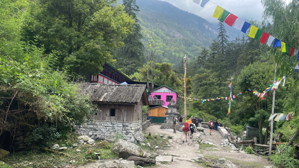
Day 06 Deng (1,804m) → Namrung (2,630m / 8,628ft)
- Starting Point: Deng (1,804m)
- Ending Point: Namrung (2,630m / 8,628ft)
- Trek Duration: 6–7 hours approx.
- Distance: 15–16 km approx.
- Altitude Gain/Loss: +826m
- Accommodation: Teahouse
- Meals: Breakfast, Lunch, Dinner
Route Highlights:
- Budhi Gandaki River crossings via suspension bridges
- Villages of Bhee Phedi and Ghap
- Ridgelines of Rana and Bihi Phedi
- Lush forests within the Manaslu Conservation Area
- Prok viewpoint for panoramic views of Siringi Mountain
- Local Gompas, Mani walls, and prayer flags
Special Experiences:
- Immersing in authentic local culture in Bhee Phedi and Ghap
- Scenic views of snowcapped peaks along the trail
- Walking through forests with a chance to spot wild monkeys
- Visiting traditional Gompas and observing Buddhist rituals
Challenges/Notes:
- The Deng to Bhee Phedi section is mostly uphill and can be physically demanding.
- The Bhee Phedi to Ghap section follows an earthquake-affected route; caution is required.
- Final ascent to Namrung includes suspension bridge crossings and a steep climb — pace yourself and follow your guide’s instructions.
- Altitude gain is significant; stay hydrated and take short breaks for acclimatization.
Itinerary Description:
After leaving Deng, today’s trek begins with a challenging uphill hike toward Bhee Phedi, a charming village offering stunning views of the Budhi Gandaki River, nearby mountain peaks, Mani walls, and local Gompas. The combination of natural beauty and cultural heritage makes this section particularly rewarding.
From Bhee Phedi, the trail follows a forested path toward Ghap, passing through the earthquake-affected route. Keep an eye out for wild monkeys along the way. After approximately an hour of trekking, you’ll reach Ghap, where a short break allows you to rest and enjoy the village scenery.
The final leg to Namrung takes about two hours. Initially, the trail follows the Budhi Gandaki River bank, offering gentle walking and scenic views. After crossing a suspension bridge, the path ascends steeply toward Namrung village. Surrounded by majestic peaks, dense forests, and traditional Gompas, Namrung is a perfect place to rest and immerse yourself in the culture of the Manaslu region.
Overnight Stay: Namrung
Day 07 Namrung (2,630m) → Samagaon (3,530m / 11,580ft) via Shyala, Lo, and Sho
- Starting Point: Namrung (2,630m)
- Way Points: Shyala (3,760m), Lo, Sho
- Ending Point: Samagaon (3,530m / 11,580ft)
- Trek Duration: 7–8 hours approx.
- Distance: 18–20 km approx.
- Altitude Gain/Loss: +1,050m / –250m
- Accommodation: Teahouse
- Meals: Breakfast, Lunch, Dinner
Route Highlights:
- Suspension bridges along the Budhi Gandaki River
- Villages of Shyala, Lo, Sho, and Samagaon
- Pine, rhododendron, and juniper forests
- Stunning mountain views of Manaslu I, Himchuli, Nadi Chuli, and Lamjung Himal
- Traditional Gompas, Mani walls, and Stupas
Special Experiences:
- Visiting Shyala village, with its monastery, stupa, mani wall, school, and health post
- Observing 50+ local Buddhist households and experiencing authentic Himalayan culture
- Walking through Lo village, with multiple monasteries and panoramic views of Manaslu
- Scenic photography of peaks from Sho village, and exploring its small hotels and cultural spots
- Experiencing Samagaon, the largest cultural hub in the Manaslu region
Challenges/Notes:
- The trail climbs steadily from Namrung to Shyala; some sections are steep.
- Descending to Lo, Sho, and Samagaon involves uneven terrain; careful footing is needed.
- Altitude gain is significant; acclimatize well and take breaks along the way.
Itinerary Description:
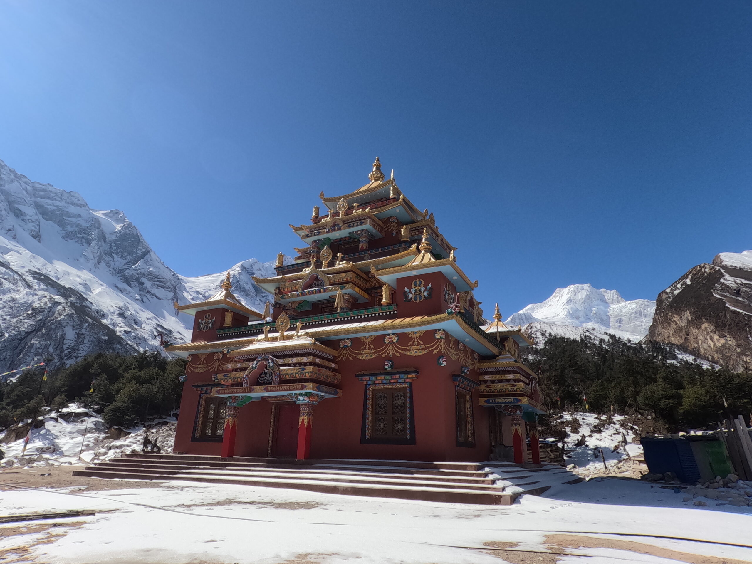
The trek begins from Namrung (2,630m), gradually ascending through forests and valleys toward Shyala (3,760m / 12,335ft). Shyala is a serene settlement with a monastery, stupa, mani wall, school, and health post, offering stunning views of Manaslu, Himchuli, and Nadi Chuli. The village is home to approximately 50 Buddhist households, providing trekkers with a rich cultural experience.
From Shyala, the trail continues to Lo village, passing dense forests and open slopes, where trekkers can explore local monasteries and enjoy panoramic Himalayan vistas. The path then leads to Sho village, offering close-up views of Manaslu I, Himchuli, and surrounding peaks, along with small hotels and cultural sites perfect for photography and rest stops.
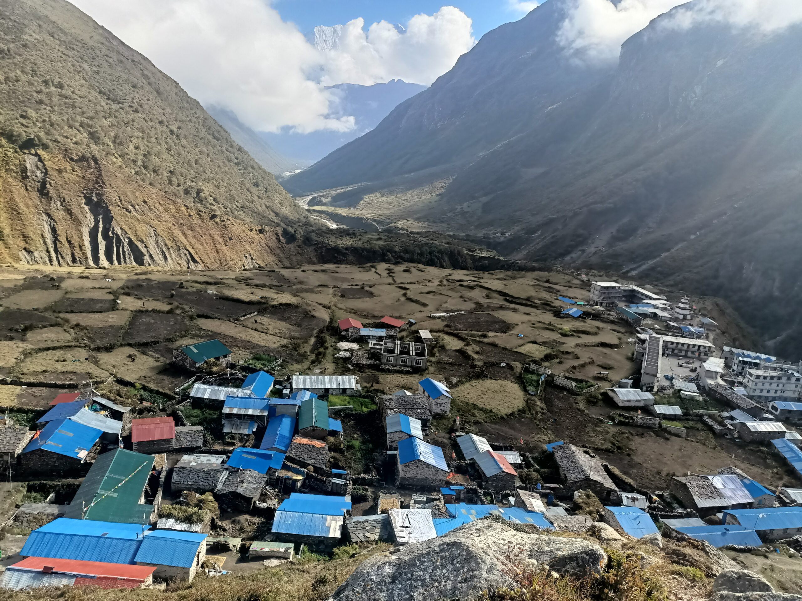
Finally, the trail descends gently to Samagaon (3,530m / 11,580ft), the largest village in the Manaslu region. Samagaon is a cultural hub with monasteries, traditional houses, and Tibetan-influenced architecture, surrounded by majestic peaks. This is an ideal location for acclimatization, overnight rest, and preparing for higher altitude trekking ahead.
Overnight Stay: Samagaon
Day 08 Rest and Acclimatization in Samagaon (Option 1 or Option 2)
- Location: Samagaon (3,530m / 11,580ft)
- Trek Duration: Optional, depending on choice
- Accommodation: Teahouse
- Meals: Breakfast, Lunch, Dinner
Option 1: Side Trip to Manaslu Base Camp
- Route Highlights:
- Manaslu Base Camp (4,800m / 15,748ft) with panoramic Himalayan views
- Scenic trails along the Budhi Gandaki valley
- Special Experiences:
- Spectacular views of Mount Manaslu and surrounding peaks
- Photography opportunities at high altitude
- Optional short rest stops and acclimatization
- Challenges/Notes:
- Steady climb to 4,800m; take regular breaks and drink plenty of water
- Trekking poles recommended for stability
- High-altitude hike; monitor for any symptoms of altitude sickness
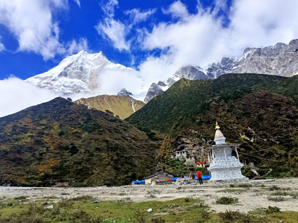
Option 2: Short Hike to Pungyen Gompa
- Route Highlights:
- Pungyen Gompa hillside monastery
- Thousands of mani stones with Buddhist inscriptions
- Views of Samagaon village and surrounding Himalayan peaks
- Special Experiences:
- Acclimatization walk at moderate altitude
- Immersing in Tibetan-Buddhist culture and local traditions
- Easy photography opportunities and gentle exploration
- Challenges/Notes:
- Short, moderate hike; ideal for acclimatization
- Trail is uneven in some places; take care on rocky sections
Itinerary Description:
Today is dedicated to rest and acclimatization in Samagaon. Trekkers may choose between:
Option 1, a full-day side trip to Manaslu Base Camp, which involves a gradual but steady climb to 4,800m. The trail offers breathtaking views of Mount Manaslu and the surrounding Himalayan peaks. Take breaks for hydration, photos, and acclimatization before descending safely back to Samagaon.
Option 2, a shorter and gentler hike to Pungyen Gompa on a nearby hill. Explore the hillside monastery, walk among thousands of mani stones, and observe the local Tibetan-influenced culture. This option is ideal for trekkers who prefer moderate activity while still aiding acclimatization.
Overnight Stay: Samagaon
Day 09 Samagaon (3,530m) → Samdo (3,875m / 12,713ft)
- Starting Point: Samagaon (3,530m)
- Ending Point: Samdo (3,875m / 12,713ft)
- Trek Duration: 4–5 hours approx.
- Distance: 8–10 km approx.
- Altitude Gain: +345m
- Accommodation: Teahouse
- Meals: Breakfast, Lunch, Dinner
Route Highlights:
- Descending to the Budhi Gandaki River and crossing a side stream via suspension bridge
- Numerous Mani walls along the trail
- Panoramic mountain views of the Manaslu region
- Approaching the Tibetan border
- Villages of Samdo and surrounding hamlets
Special Experiences:
- Hiking through traditional Buddhist settlements with rich Himalayan culture
- Observing hundreds of mani stones and prayer flags
- Optional hike to Samdo Peak for panoramic views of the valley and surrounding peaks
- Experiencing proximity to the Tibetan border and cultural influences
Challenges/Notes:
- The trail includes some descending sections to the river followed by gentle climbs; take care on uneven terrain.
- Weather can be unpredictable; dress in layers and carry extra warm clothing.
- Optional hike to Samdo Peak involves moderate climbing; proper footwear is recommended.
Itinerary Description:
Leaving Samagaon, the trail descends toward the Budhi Gandaki River, crossing a side stream via a suspension bridge. Along the way, you’ll encounter numerous Mani walls, vibrant prayer flags, and spectacular mountain views.
As you get closer to Samdo, the trail reveals cultural and natural highlights of the region, including small villages and traditional Tibetan-Buddhist settlements. Upon arrival at Samdo (3,875m / 12,713ft), trekkers can explore nearby villages or opt for a short climb to Samdo Peak, which offers panoramic views of the valley, the Manaslu massif, and the trail toward Larkya La Pass, visible on the left side above the valley.
Overnight Stay: Samdo
Day 10 Acclimatization in Samdo and Visit to Tibetan Border (4,800m / 15,748ft)
- Location: Samdo (3,875m / 12,713ft)
- Trek Duration: 4–5 hours (round trip to Tibetan border)
- Altitude Gain: +925m (to Tibetan border)
- Accommodation: Teahouse
- Meals: Breakfast, Lunch, Dinner
Route Highlights:
- Gentle hike from Samdo to the Tibetan border
- Spectacular views of Syacha Glacier, surrounding Himalayan peaks, and high-altitude valleys
- Traditional Samdo village, local monastery, and Buddhist cultural sites
- Observing Tibetan-influenced architecture and traditions
Special Experiences:
- Visiting the Tibetan border at high altitude (4,800m / 15,748ft)
- Stunning panoramic views of Manaslu and nearby Himalayan peaks
- Exploring Samdo village, its monastery, and interacting with local residents
- Optional short walks around the village for further acclimatization
Challenges/Notes:
- High-altitude hike; pace yourself carefully and monitor for altitude sickness
- Trail involves gradual ascent and descent; proper footwear and trekking poles recommended
- Carry water, snacks, extra layers, and sunscreen
- Weather can be unpredictable at high altitudes; dress in layers
Itinerary Description:
Start your day with a hearty breakfast at your teahouse in Samdo (3,875m). Prepare for a gentle yet important acclimatization hike by packing essentials such as water, snacks, extra layers, sunscreen, and a hat.
The trail gradually ascends toward the Tibetan border, offering breathtaking views of high Himalayan peaks, valleys, and the Syacha Glacier. Take short breaks along the way to hydrate, enjoy snacks, and capture photos of the surrounding landscape.
Upon reaching the Tibetan border (4,800m / 15,748ft), spend time marveling at the panoramic vistas and the unique experience of standing close to Tibet. After soaking in the views, carefully descend back to Samdo, taking in the beautiful scenery along the trail.
In the afternoon, explore Samdo village, visiting the local monastery and interacting with villagers to learn about Tibetan-influenced culture and traditions. Gentle walks around the village or its outskirts help with further acclimatization. Return to the teahouse for a nourishing dinner and spend the evening relaxing, hydrating, and preparing for the challenging trek ahead.
Overnight Stay: Samdo
Day 11 Samdo (3,875m) → Dharmasala / Larkya Phedi (4,460m / 14,632ft)
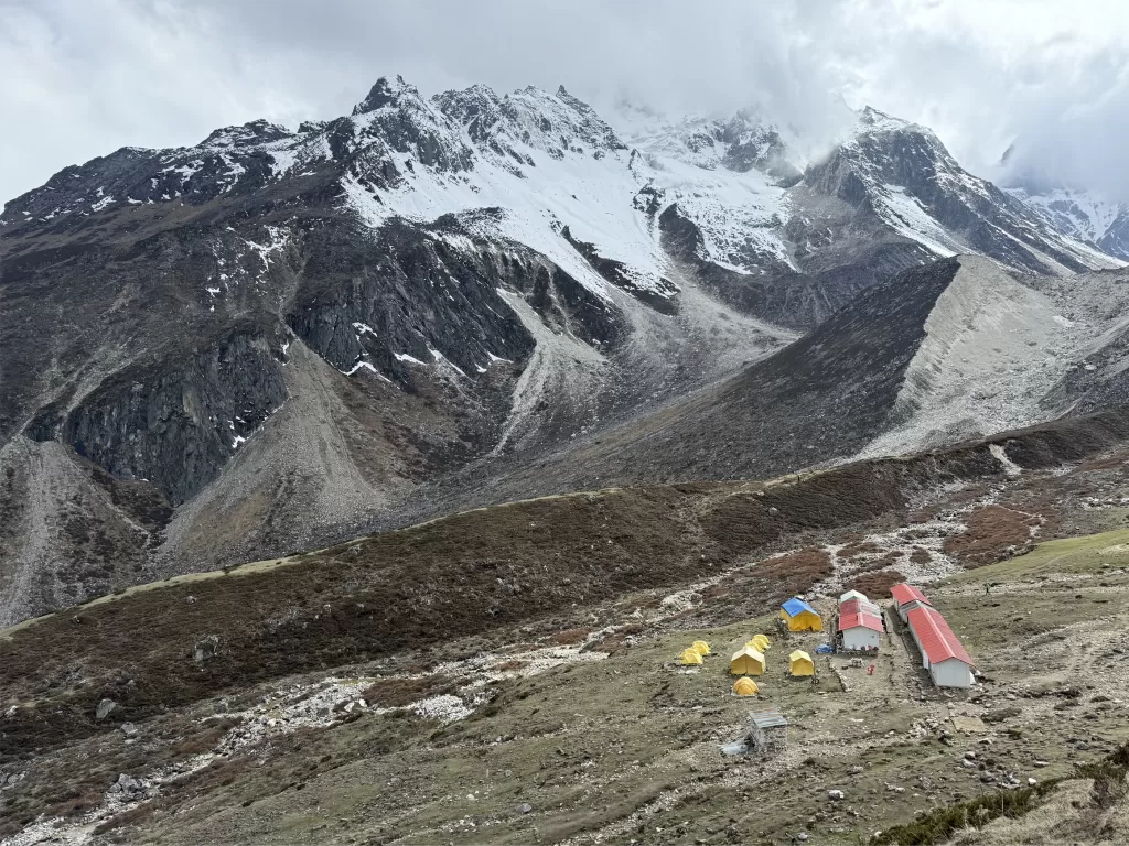
- Starting Point: Samdo (3,875m / 12,713ft)
- Ending Point: Dharmasala / Larkya Phedi (4,460m / 14,632ft)
- Trek Duration: 4–5 hours approx.
- Distance: 8–10 km approx.
- Altitude Gain: +585m
- Accommodation: Teahouse / High-altitude shelter
- Meals: Breakfast, Lunch, Dinner
Route Highlights:
- Traditional Samdo village with Tibetan-influenced culture
- Crossing a high-altitude icy stream
- Stark, dramatic landscapes transitioning to rocky, barren slopes
- Larkya Phedi (Dharmasala) surrounded by Himalayan peaks
Special Experiences:
- Observing Samdo’s unique culture and architecture before leaving the village
- Witnessing panoramic views of high-altitude terrain and snow-capped peaks
- Optional short acclimatization hike from Dharmasala (approx. +200m)
- Preparing mentally and physically for the challenging Larkya La Pass crossing
Challenges/Notes:
- High-altitude trekking requires careful pacing; move slowly to allow for proper acclimatization
- Terrain transitions from icy streams to rocky slopes; trekking poles recommended
- Dress in layers and carry warm clothing due to cold winds and high-altitude conditions
- Keep hydrated and take breaks frequently
Itinerary Description:
Today, the trek begins from Samdo (3,875m), a peaceful village where trekkers can observe local Tibetan-influenced culture and enjoy the serene surroundings. The trail gradually ascends, crossing a high-altitude icy stream, then moves into a dramatic, drier landscape with rocky, barren slopes typical of high Himalayan terrain.
Although the trek is moderate in distance, the significant altitude gain requires a relaxed pace for safe acclimatization. Arriving at Dharmasala / Larkya Phedi (4,460m / 14,632ft) by midday, trekkers have the afternoon free to rest. For better acclimatization, it is recommended to take a short hike of about 200 meters from Dharmasala, which helps prepare for tomorrow’s challenging crossing of Larkya La Pass.
Overnight Stay: Dharmasala / Larkya Phedi
Day 12 Dharmasala / Larkya Phedi (4,460m) → Bimthang (3,590m / 11,778ft) via Larkya La Pass (5,106m / 16,762ft)
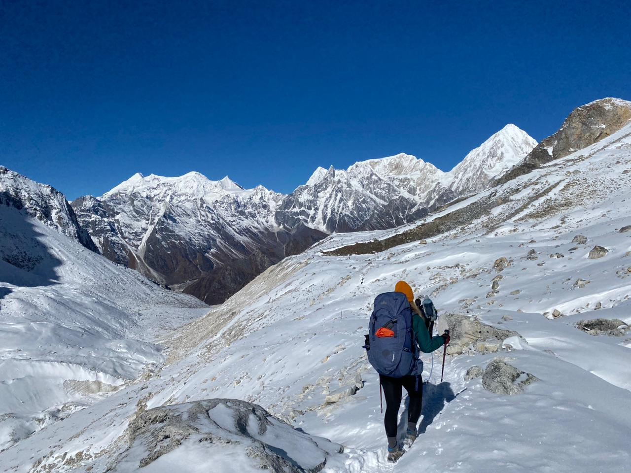
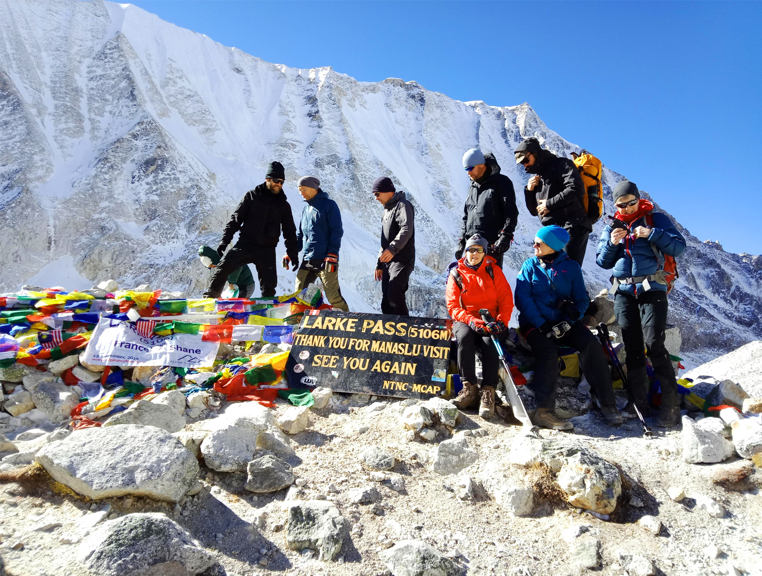
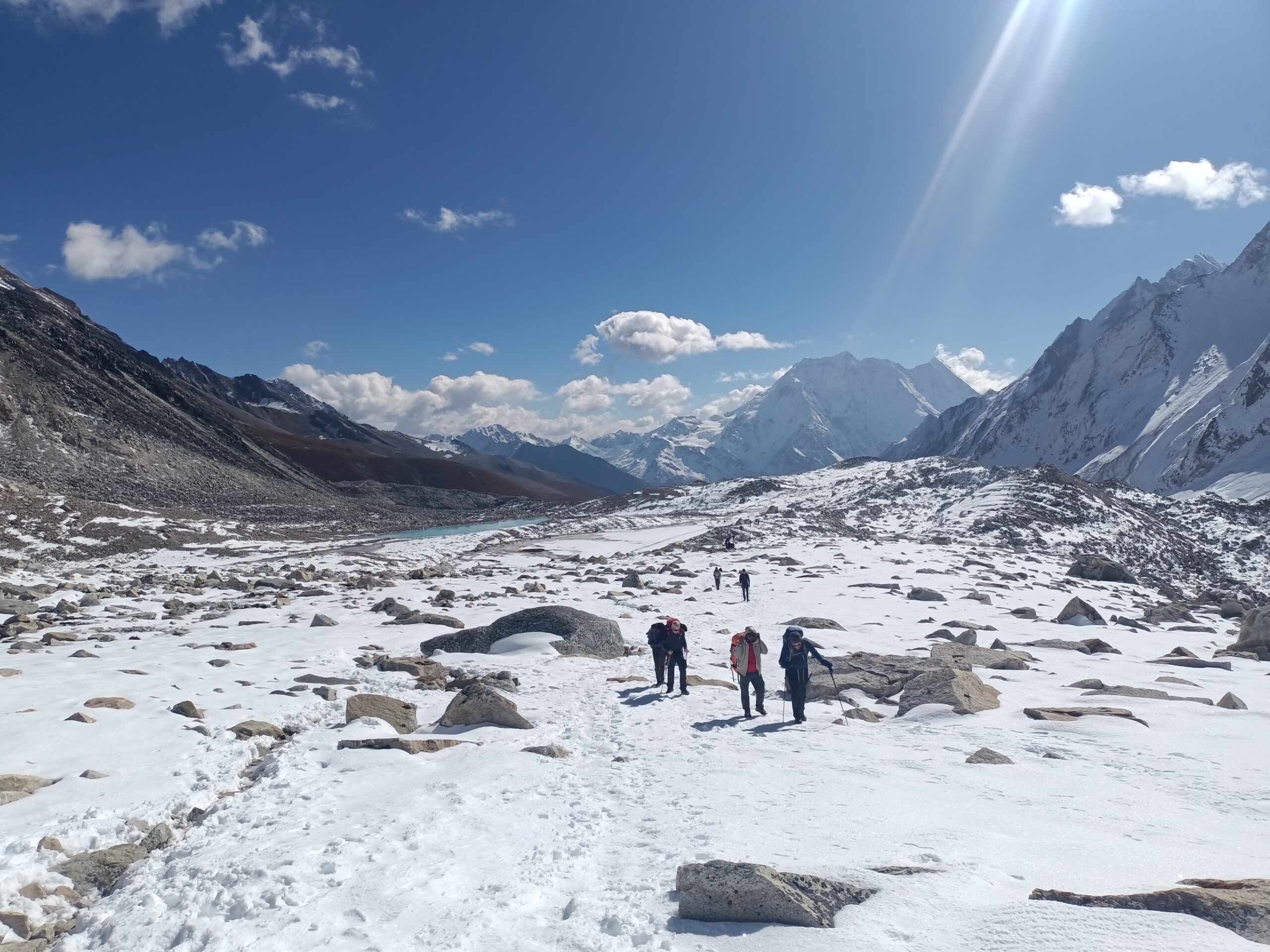
- Starting Point: Dharmasala / Larkya Phedi (4,460m / 14,632ft)
- Ending Point: Bimthang (3,590m / 11,778ft)
- Trek Duration: 8–10 hours approx.
- Distance: 15–18 km approx.
- Altitude Gain/Loss: +646m / –1,516m
- Accommodation: Teahouse / Lodge
- Meals: Breakfast, Lunch, Dinner
Route Highlights:
- Larkya La Pass (5,106m / 16,762ft) — the highest point of the Manaslu Circuit Trek
- Panoramic views of Mt. Manaslu, Larkya Peak, Bouddha Himal, Himalchuli, and Peak 29
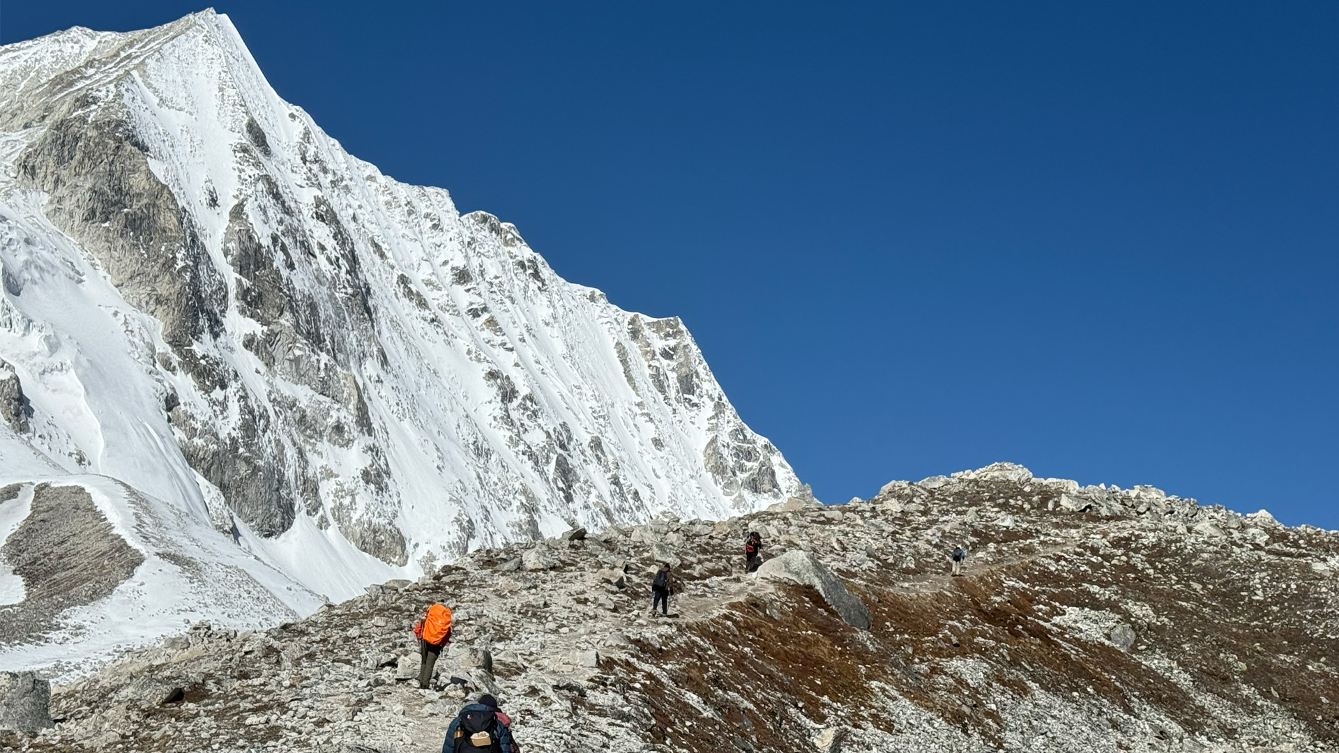
- High-altitude alpine landscapes, glacial terrain, and rugged mountain trails
- Descent into Bimthang village, surrounded by serene valleys and towering peaks
Special Experiences:
- Conquering Larkya La Pass, the ultimate highlight of the Manaslu Circuit Trek
- Admiring fluttering Buddhist prayer flags at the pass
- Capturing breathtaking panoramic photographs of Himalayan giants
- Experiencing the peaceful ambiance of Bimthang village after a challenging day
Challenges/Notes:
- Early start required to tackle the steep ascent to Larkya La Pass
- High-altitude trekking; proper acclimatization and hydration are crucial
- Descent involves steep and slippery trails, sometimes with ice — trekking poles and crampons recommended
- Pace yourself and follow the guide’s instructions carefully for safety
Itinerary Description:
Today is the highlight of the Manaslu Circuit Trek: crossing Larkya La Pass (5,106m / 16,762ft). We begin early from Dharmasala / Larkya Phedi (4,460m) to ensure adequate daylight and safe trekking conditions. The ascent is strenuous but incredibly rewarding, with sweeping panoramic views of Mt. Manaslu, Larkya Peak, Bouddha Himal, Himalchuli, and Peak 29. At the summit, admire the fluttering Buddhist prayer flags and soak in the stunning alpine scenery, celebrating the achievement of reaching one of the highest passes in Nepal.
The descent toward Bimthang (3,590m / 11,778ft) requires careful navigation of steep, sometimes icy terrain. Trekking poles and crampons are highly recommended for stability. As the trail gradually levels out, you enter the tranquil Bimthang valley, surrounded by towering peaks and high mountain serenity. This is the perfect place to rest, recover, and reflect on the accomplishment of conquering Larkya La Pass.
Overnight Stay: Bimthang
Day 13 Bimthang (3,590m) → Dharapani (1,860m / 6,102ft)
- Starting Point: Bimthang (3,590m / 11,778ft)
- Ending Point: Dharapani (1,860m / 6,102ft)
- Trek Duration: 6–7 hours approx.
- Distance: 18–20 km approx.
- Altitude Loss: –1,730m
- Accommodation: Teahouse / Lodge
- Meals: Breakfast, Lunch, Dinner
Route Highlights:
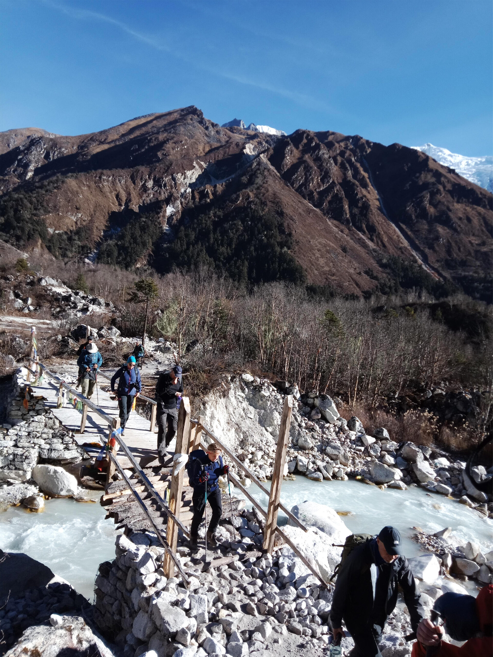
- Crossing suspension bridges over the Punkar River and Dudh Khola
- Lush forests with rhododendron, oak groves, and alpine flora
- Scenic Gurung villages such as Goa and Tilije
- Fertile valleys and agricultural landscapes
- Traces of glacial floods, adding rugged charm to the trail
Special Experiences:
- Enjoying the final scenic descent through the Manaslu region
- Capturing photos of vibrant forests, terraced fields, and traditional villages
- Experiencing local Gurung culture along the trail
- A sense of accomplishment as you complete the Manaslu Circuit Trek
Challenges/Notes:
- Long descent; careful footing is needed on rocky or uneven sections
- Some areas show evidence of past glacial floods with scattered tree trunks and eroded riverbanks
- Carry sufficient water and snacks for energy on the last day
Itinerary Description:
Begin your descent from Bimthang (3,590m), crossing a suspension bridge over the Punkar River and moving through lush forests filled with rhododendron and oak groves. The trail passes the Dudh Khola, leading you to Karche, where you pause for lunch amid the serene Himalayan scenery.
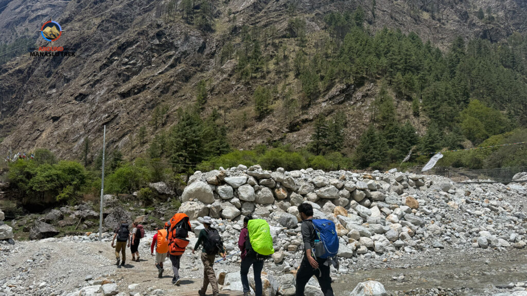
After lunch, the landscape reflects the region’s glacial history, with scattered tree trunks and eroded riverbanks, adding rugged charm to the trail. Continue to the charming Gurung village of Goa, the first settlement encountered since Samdo. The valley gradually widens, revealing fertile fields, terraced farms, and vibrant rhododendron forests.
Following the north (true right) bank of the river, the trail passes through Tilije before reaching Dharapani (1,860m / 6,102ft). This final stretch combines natural beauty with rural Himalayan charm, marking the completion of your Manaslu Circuit Trek.
Overnight Stay: Dharapani
Day 14 Dharapani (1,860m) → Kathmandu (1,350m / 4,429ft)
- Starting Point: Dharapani (1,860m / 6,102ft)
- Ending Point: Kathmandu (1,350m / 4,429ft)
- Travel Duration: 9–10 hours approx. (including jeep and road transfer)
- Meals: Breakfast and Lunch
Route Highlights:
- Scenic drive through forested hills, terraced fields, and picturesque villages
- Travel through Besisahar, the gateway to the Manaslu region
- Winding mountain roads with panoramic views of the surrounding Himalayas
Special Experiences:
- Enjoying the final journey back from the mountains to the vibrant Kathmandu valley
- Reflection on the cultural encounters and natural beauty experienced throughout the Manaslu Circuit Trek
- Opportunity for photography of lush landscapes and traditional villages along the route
Challenges/Notes:
- The shared jeep from Dharapani to Besisahar may be crowded; private vehicles are recommended for comfort and flexibility
- Roads can be winding and uneven; drive safely
- Carry essential items and snacks for the road
Itinerary Description:
After an early breakfast at Dharapani, the journey begins with a scenic 3-hour jeep ride to Besisahar, passing through lush forests, terraced fields, and charming villages. Upon arrival in Besisahar, the journey continues by road for approximately 6–7 hours back to Kathmandu. For a more comfortable and flexible experience, a private vehicle is recommended.
Arriving in Kathmandu, the adventure officially concludes. Trekkers are greeted by the bustling city atmosphere while carrying unforgettable memories of the Manaslu Circuit Trek, including majestic mountains, traditional Himalayan villages, cultural encounters, and thrilling high-altitude experiences.
Day 15Final Departure: Transfer to the Airport
On the day of your departure, we will arrange a seamless transfer to Tribhuvan International Airport (TIA), ensuring you reach on time and with ease. As you bid farewell to Nepal, we wish you a safe and pleasant journey ahead, filled with wonderful memories of your adventure.
What’s included
- All airport-hotel transfers
- 3 times (Full board) meal per day during the trek
- Seasonal Fruits
- Tea house accommodation during the trek (twin shared accommodation)
- All land transportation as per itinerary (Kathmandu to Machha Khola and Dharapani to Kathmandu by local bus)
- A professional government licensed trekking guide
- All required permits (Restricted area permit, TIMS, Manaslu Conservation Area Permit, and Annapurna Conservation Area Permit)
- Travel and rescue arrangements only
- Duffel bag to carry your equipment and trekking map
- All necessary paper works
- Farewell dinner
- Basic medical kit
- All government and local taxes
What’s not included
- International airfares
- A porter (A porter can carry up to 15 – 20 kg – 1 porter for 2 trekkers) – total costs USD $300
- Private jeep (Kathmandu to Soti Khola drive and Dharapani to Kathmandu) – costs USD $480
- Boutique hotel accommodation in Kathmandu with breakfast included (Optional:4-star hotel)
- Lunch and Dinner in Kathmandu
- Tips for guide and porter
- All additional costs (such as beverages, shopping, etc)
- Travel and rescue insurance
- All the things not mentioned in the inclusion
Manaslu Circuit Trek Fixed Departure Dates and Cost for Spring & Autumn 2026/2027
| Departure Dates | Price (USD) PP | Availability | Action |
|---|---|---|---|
| September 3, 2026 | $1070 | Available | Book Now |
| September 7, 2026 | $1070 | Available | Book Now |
| September 12, 2026 | $1070 | Available | Book Now |
| September 16, 2026 | $1070 | Available | Book Now |
| September 20, 2026 | $1070 | Available | Book Now |
| September 25, 2026 | $1070 | Available | Book Now |
| September 28, 2026 | $1070 | Available | Book Now |
| October 2, 2026 | $1070 | Available | Book Now |
| October 5, 2026 | $1070 | Available | Book Now |
| October 7, 2026 | $1070 | Available | Book Now |
| October 10, 2026 | $1070 | Available | Book Now |
| October 14, 2026 | $1070 | Available | Book Now |
| October 17, 2026 | $1070 | Available | Book Now |
| October 25, 2026 | $1070 | Available | Book Now |
| October 27, 2026 | $1070 | Available | Book Now |
| November 3, 2026 | $1070 | Available | Book Now |
| November 5, 2026 | $1070 | Available | Book Now |
| November 10, 2026 | $1070 | Available | Book Now |
| November 15, 2026 | $1070 | Available | Book Now |
| March 05, 2027 | $1070 | Available | Book Now |
| March 15, 2027 | $1070 | Available | Book Now |
| March 20, 2027 | $1070 | Available | Book Now |
| March 26, 2027 | $1070 | Available | Book Now |
| April 01, 2027 | $1070 | Available | Book Now |
| April 05, 2027 | $1070 | Available | Book Now |
| April 10, 2027 | $1070 | Available | Book Now |
Fixed Departures dates of Manaslu Circuit Trek 2026 Autumn and 2027.
Tip: If you’re traveling solo and would like to join a group at your preferred time, let us know and book in advance. We’ll do our best to find other trekkers for you to team up with.
Note: We also offer group discounts as outlined below:
| No. of Travelers | Price Per Person (USD) |
| 1 – 1 | $1070 |
| 2 – 2 | $920 |
| 3 – 6 | $880 |
Note: To confirm your trip booking, a minimum advance payment of 10% is required. Once we receive the payment, a detailed invoice will be sent to you.
Best Time to Trek Manaslu Circuit
There are four distinct seasons for trekking in the subtropical Nepal Himalayas: spring, autumn, winter, and summer, each offering its own unique experience.
Spring (March to May):
Spring is one of the best seasons for trekking in Nepal, particularly the Manaslu Circuit. The weather is warm, and the hillsides are bursting with colorful wildflowers, including blooming rhododendrons. The trails offer clear mountain views, and the temperatures are moderate, making for comfortable trekking conditions. Spring also marks the climbing season, so you may encounter mountaineers preparing for expeditions. However, as it’s a popular time, the trails can be busy.
Autumn (September to November):
Autumn is the most popular season for trekking in Nepal, thanks to its stable weather and clear skies. After the monsoon rains, the air is crisp and fresh, offering some of the clearest mountain views of the year. Temperatures are mild during the day and cooler at night, ideal for trekking. This is the peak trekking season, so expect more people on the trails, but the experience of trekking in such perfect conditions makes it worthwhile.
Winter (December to February):
Winter trekking in Nepal is much quieter and offers a more peaceful experience. While it does get colder, especially at higher altitudes, the lower number of trekkers means you can enjoy the solitude of the mountains. Nepal’s winter isn’t as harsh as in countries like Canada or northern Europe, and the skies are often clear, providing great mountain views. However, some high-altitude passes may be blocked by snow, so it’s important to plan your trek accordingly.
Summer (June to August):
Summer in Nepal coincides with the monsoon season, bringing heavy rains, especially in lower altitudes and forested areas. The trails can be muddy and slippery, and the mountains are often shrouded in clouds. However, this is the least crowded season, and the landscapes are lush and green. Some trekkers still venture out during this time, particularly to rain-shadow areas like Upper Mustang or Dolpo, which are drier and offer more favorable conditions. For those trekking the Manaslu Circuit in summer, be prepared for leeches and frequent rain showers, but you’ll also experience a quieter and more verdant trekking environment.
To learn more about the best seasons, weather patterns, and month-by-month tips for planning your adventure, visit our detailed guide on Best Time to Trek Manaslu Circuit.
Each season in the Nepal Himalayas has its own charm, making trekking possible year-round depending on your preferences and tolerance for different weather conditions.
Food and Accommodation
You will be served meals on a full-board basis during the trek, while only breakfast is provided during your stay in Kathmandu. Throughout the trek, you will receive three meals a day (breakfast, lunch, and dinner), each with a cup of tea or coffee, served from local tea houses. Dinner and breakfast are typically served at the tea house where you stay overnight, while lunch is taken at a tea house along the trekking route.
Please note that the variety of food may be limited compared to better-developed trekking regions like Annapurna and Everest. However, you’ll still enjoy wholesome and culturally rich meals such as Dal Bhat, Tibetan bread, Tsampa porridge, and other local specialties.
For breakfast, you’ll find items such as Tibetan bread with honey or jam, porridge made with local honey, or eggs prepared in various styles—boiled, fried, or scrambled—served with chapati or toast. Lunch and dinner are similar and often include Thukpa (noodle soup), which is perfect for chilly evenings in the mountains. Despite the simplicity, the meals are nutritious and energizing—ideal for a challenging trek like this.
👉 For a full breakdown of recommended dishes, food safety tips, and dietary options on the trail, check out our detailed article on Manaslu Circuit Trek Food & What to Eat During the Manaslu Trek.
Accommodation:
Upon arrival in Kathmandu, if you opt for our airport pick-up service, you’ll be transferred to your hotel. We typically provide a boutique hotel in Kathmandu, with breakfast included. You’ll have a private room during your city stay. Kathmandu offers a range of accommodations, from 5-star hotels to homestays.
During the trek, you’ll be staying in tea house accommodation since there are no luxury lodges in the Manaslu region. These are locally-run guesthouses offering basic yet cozy lodging, contributing to the authentic experience of what’s known as a tea house trek in Nepal. Deluxe or star-rated hotels do not exist in the Himalayan trekking zones like Manaslu, which adds to the remote charm of the journey.
Manaslu Circuit Trek Difficulty (Altitude Sickness, Acclimatization, and Training)
All trekking routes in the Manaslu region reach up to 5,106 meters in altitude at Larkya La Pass, which can cause altitude sickness. While crossing Larkya La Pass, you may encounter altitude sickness. Therefore, before embarking on your Manaslu circuit trek, it is essential to understand its symptoms and the process of acclimatization. Note that although all the trekking in Manaslu is moderate, it can be quite strenuous. Nevertheless, a trekker aged between 58-65 years can successfully complete this trek with proper acclimatization.
Manaslu circuit trek often requires at least 5-6 hours of walking every day. Whereas, you also need to walk 8-9 hours on some days that including walking in Larkya la pass. Therefore, we suggest you get prepared with walking or jogging exercises every day 3 months prior to the trip. Then, you will be able to walk in physically demanding high altitude and remote places. To enjoy this trip, you should bring willpower and the ability to tolerate harsh conditions.
For a complete breakdown of altitude concerns, training tips, and acclimatization strategies, check out our detailed guide on the Manaslu Circuit Trek difficulty.
Travel and Trekking Insurance
Travel and trekking insurance is mandatory for the Manaslu Circuit Trek. While the risk of injury on this trek is relatively low, having comprehensive travel insurance is essential to cover medical expenses and emergency helicopter rescue in case of an unforeseen incident.
Your insurance should specifically cover trekking at altitudes up to 6,000 meters, as this is higher than what most standard travel insurance policies include by default. You’ll often need to add high-altitude trekking coverage separately.
👉 For a detailed overview of what your insurance should include, check out our guide on Travel Insurance for Trekking in Nepal.
Also, be aware of potential pitfalls—especially in remote regions. To protect yourself further, we strongly recommend reading our article on Helicopter Rescue Scams in Nepal so you know what to avoid.
Is Travel Insurance Mandatory for the Manaslu Circuit Trek?
Yes, travel insurance is mandatory. Given the remote location and challenging terrain of the Manaslu Circuit, it’s crucial that your policy includes:
- High-altitude trekking coverage (up to 5,000–6,000 meters)
- Helicopter evacuation services
- Emergency medical expenses
- Trip interruption or cancellation protection
Having the right insurance ensures your safety, supports rescue operations if needed, and gives you peace of mind throughout your adventure.
Packing lists for Manaslu Circuit Trek
The packing list for the Manaslu Circuit Trek varies depending on the season, but there are several essential items that every trekker should bring. Trekking gear such as a down jacket, sleeping bag, hiking boots, trekking poles, sunglasses, hiking trousers, T-shirts, and woolen or hiking socks are a must for comfort and safety. While some of this gear can be rented in Kathmandu, we strongly recommend bringing your own personal essentials, especially for hygiene and comfort.
For a full breakdown of season-wise gear recommendations, rental options, and expert tips, visit our detailed article on the Manaslu Circuit Trek Packing List.
Necessary Permits
To trek the Manaslu region, foreigners are required to obtain three different permits:
- Manaslu Restricted Area Permit (RAP)
- Manaslu Conservation Area Permit (MCAP)
- Annapurna Conservation Area Permit (ACAP)
Due to its location in a restricted zone, the Manaslu trek requires at least one trekker accompanied by a licensed local guide to secure the special restricted permit. This regulation is also applicable to other restricted treks like Upper Mustang and Upper Dolpo.
For complete details on the requirements, cost, and how to obtain them, refer to our guide on Manaslu Circuit Trek Permits – Requirements and Fees.
Transportation
Nowadays, local buses provide easy access to Soti Khola and Machha Khola, where the trek begins. Alternatively, you can choose a private vehicle, such as a jeep or Hiace, or opt for a shared jeep for a more comfortable ride.
Local buses take approximately 9 hours to reach Machha Khola. While this is a more budget-friendly option, it can be quite crowded, with fares around 1500 Nepalese rupees per person. On the other hand, private jeeps offer greater comfort and flexibility. They can be arranged through travel agencies or hotels and typically reach Machha Khola in about 7 to 8 hours. However, this option is more expensive, costing up to 220 USD.
Transportation Options We Provide
Beginning of the Manaslu Circuit Trek: You should follow the above itinerary. In the beginning, you need to travel to Machha Khola from Kathmandu via Soti Khola. It takes nearly 8/9 hours or 7/8 hours by local bus and private jeep respectively.
Ending of the Manaslu Circuit Trek: You will also complete your trip by driving back to Kathmandu. From Dharapani, you will return to Besisahar by shared jeep and then change to a local bus for a 7-8 hours Kathmandu drive.
Communication Medium
Now Internet WiFi service is available in most of the teahouses. You also can get SAT phone to communicate with your friends and families paying a certain amount of charge. But local telephone hardly works in this region. Mobile networks (NTC and NCELL) do also provide coverage in this region.
Trekking Map
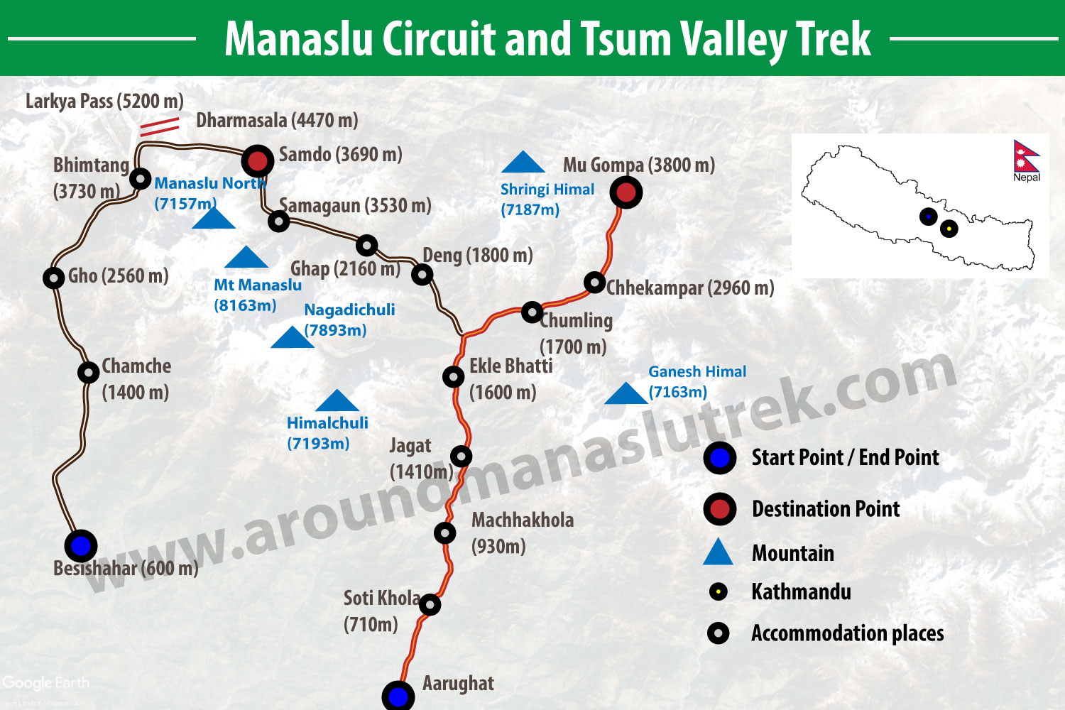
Tourist Visa Information for Manaslu Circuit Trek
All foreigners except Indian nationals require a visa to visit Nepal. Citizens of some countries like SAARC (South Asian Association for Regional Cooperation) countries and China do get free visas upon arrival in Nepal. However, the rest of the world’s people must issue visas to enter Nepal. You can easily get an arrival visa at Tribhuvan International Airport. You just require to have a passport with at least 6 months validity, a PP-size photo, and a visa fee, then you will get the visa in Nepal. As of now, the visa fee is $50 USD for 30 days which you can pay in cash.
There are a few countries like Ghana, Zimbabwe, Nigeria, Cameroon, Swaziland, Somalia, Liberia, Ethiopia, Iraq, Palestine, and Afghanistan; the citizen of these countries do not receive an on-arrival visa. They have to contact the embassy of Nepal or the nearest consulate.
Most foreign travelers can obtain a visa on arrival at Tribhuwan International Airport in Kathmandu, Nepal, provided their passport is valid for at least six months. Currently, both arrival and departure online applications must be submitted prior to your flight. For the latest regulations, please visit the official Nepal Immigration website: Nepal Immigration.
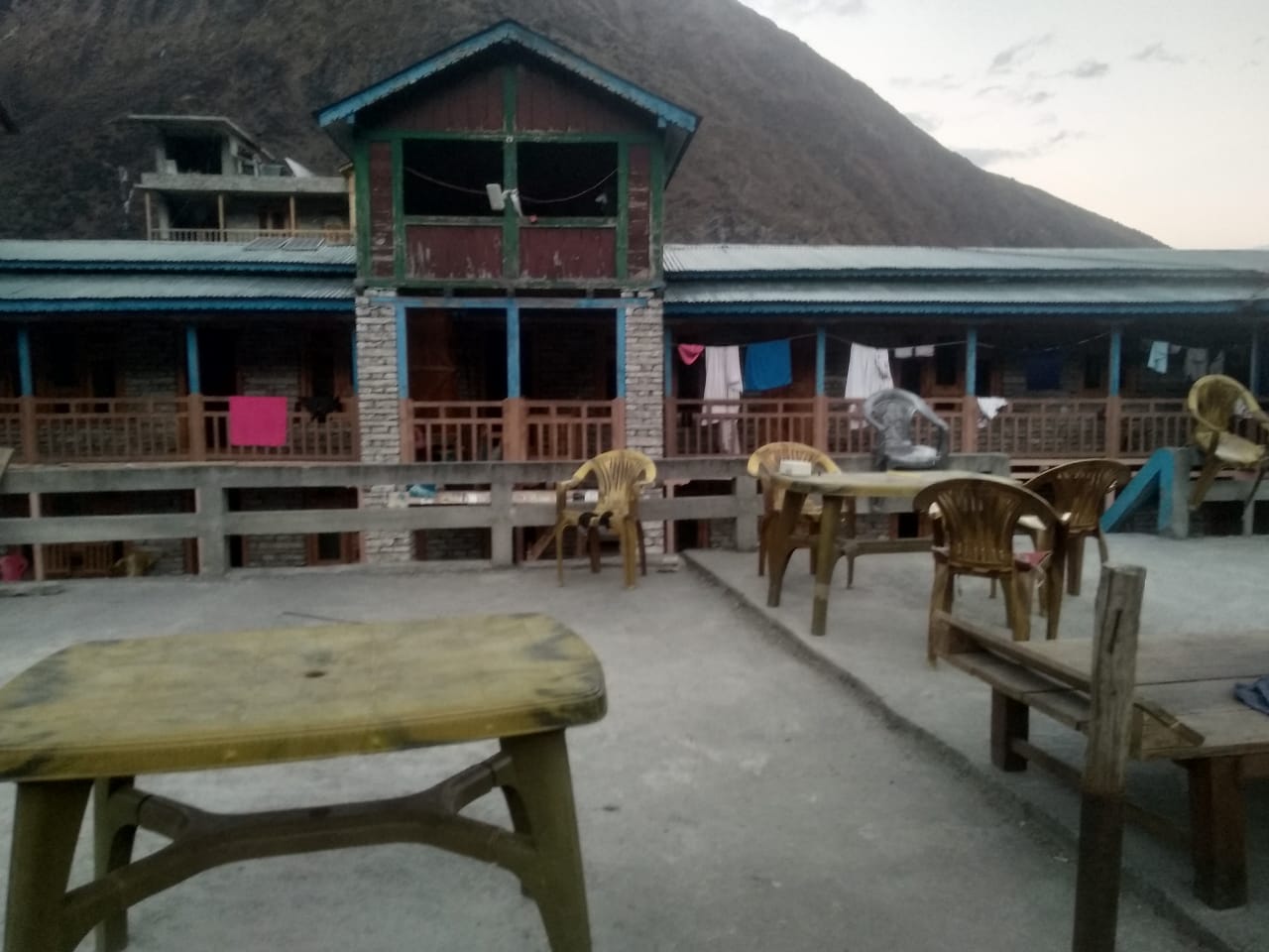
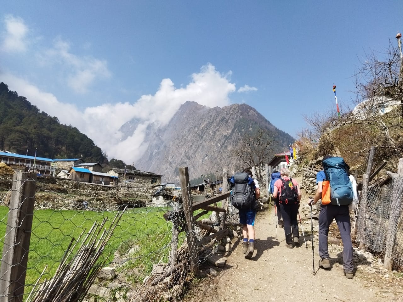
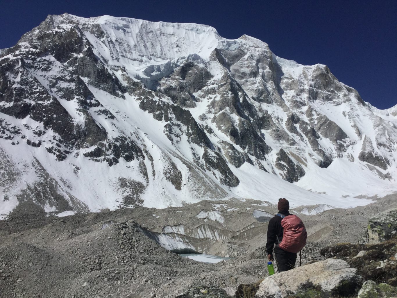
Manaslu Circuit Trek Gallery
Notes:
- We are determined to operate trekking on fixed departure dates despite a single-person booking.
- You can request your own group departure date, we will help you to find your trekking partner. Or we also operate private trip.
FAQs of the Manaslu Circuit Trek
General Information
1) Where is Manaslu located?
Manaslu is located northwest of Kathmandu bordered by the Annapurna region in the west and Langtang Ganesh Himal in the east.
2) How do I reach Manaslu from Kathmandu?
You either choose a local bus or a private vehicle to reach Manaslu. There is no fly route or waterways to reach Manaslu. It takes around 8 hrs to get there by local or private vehicle.
3) How far is Manaslu from Kathmandu?
The trekking point of Manaslu is nearly 126 km far from the capital Kathmandu. However, it is about 123 km of aerial distance from Kathmandu valley.
4) How far is the Tibetan border from Samagaun, Manaslu?
The Tibetan border is approximately 15-20 kilometers (9-12 miles) from Samagaun (also spelled Samagaon) in the Manaslu region of Nepal.
5) Which peak is the highest mountain in the Manalsu region?
Mt. Manaslu, standing at 8163m, is the highest peak in the Manaslu region and the 8th highest mountain in the world.
6) How long does it take to hike Manaslu?
The Manaslu Circuit Trek typically takes 15 days to complete, depending on the itinerary. Our 15-day itinerary includes adequate acclimatization, allowing you to cross the Larkya La Pass (5,106m) safely while enjoying the region’s spectacular mountain scenery and rich cultural heritage. If you want to explore the Tsum Valley as well, you should allow 17–18 days for the combined trek.
7) Who will pickup me at airport?
A representative from the Around Manaslu Trek Team will be at the airport to pick you up and take you to your hotel.
8) Does credit card work in Manaslu region?
There is no access to credit cards in the region because it is so rural, despite its proximity to the capital, Kathmandu. You will not find any ATMs or POS services in the Manaslu region. Therefore, you should withdraw the required cash from Kathmandu before starting the trek.
9) Is Larkya Pass difficult for beginner trekkers?
Larkya Pass is situated at an altitude of over 5106m above sea level, making it a delightful pass located in the Manaslu region. The pass is not too high, so trekking in the spring and autumn seasons may not be too challenging. However, if you wish to cross this pass in the winter season, it can be difficult because it may be covered with a full layer of snow at that time. The well-trained team of Around Manaslu Trek will ensure your trek is comfortable and successful while you are exploring the Manaslu region.
10) Is natural water drinkable on the Manaslu Circuit Trek?
Although the flowing water in mountain areas may appear very clear, we strongly advise against drinking tap water or any water from natural streams. To make it safe for consumption, you should use a water purifier or boil the water.
Cost & Permits
1) How much does Manaslu Circuit Trek Cost?
The total cost of the Manaslu Circuit Trek depends on factors like the season, duration, guide/porter services, permits, transportation, and gear. It typically ranges between $1,000 to $2000 USD per person for a standard 14–16 day trek, depending on the level of comfort and services chosen.
For a full breakdown of all expenses—including permit fees, guide and porter costs, accommodation, meals, transportation, and gear rentals. Please check out our comprehensive guide on Manaslu Circuit Trek Cost.
2) What is the cost of Manaslu Circuit Trek Permit?
The cost of the Manaslu Circuit Trek permit varies based on the season and duration of your trek between Jagat and Dharapani:
September to November:
- USD 100 per person for the first seven days.
- USD 15 per person per day from the eighth day onwards.
December to August:
- USD 75 per person for the first seven days.
- USD 10 per person per day from the eighth day onwards.
Additionally, after crossing the Larkya La pass, you will need an Annapurna Conservation Area Project (ACAP) permit. These permits are necessary to ensure the conservation and management of the areas you’ll be trekking through.
Health & Safety
1) What is the highest altitude of the Manaslu Circuit Trek?
Larkya La Pass is the highest point of this trek which is elevated at 5106 m above sea level.
2) How much altitude do we gain during the Manaslu Circuit trek ?
During the Manaslu Region trek, you gain altitude up to approximately 5,106 meters (16,781 feet) at the Larkya La Pass, which is the highest point of the trek.
3) Do I need oxygen for Manaslu Circuit Trek?
No, it is not needed for most of the cases during the trek. But if you need, then some of the teahouses contains oxygen cylinder for the emergency cases.
4) What Happens If You Get Injured on the Manaslu Trek?
While trekking in the remote Himalayas is an incredible adventure, it’s natural to wonder: what happens if someone sprains an ankle or injures a knee on the trail? The answer depends on the severity of the injury, your location on the trail, and the available support nearby.
Minor Injuries: Handled on the Trail
If it’s a minor sprain or discomfort, there’s usually no need to worry. Our experienced trekking guides are trained in first aid and will apply the R.I.C.E. method – Rest, Ice, Compression, and Elevation—to reduce pain and swelling. If needed, a guide or porter can help carry your backpack or support you with a walking stick to reach the next village or teahouse. Once there, you can rest, recover, and decide whether to continue the trek or return.
Moderate to Severe Injuries: Safety First
In the rare event of a more serious injury, our trained guides will stabilize the affected area using splints or bandages. Most parts of the Manaslu Circuit Trek now have mobile coverage or satellite phone access, so we can quickly coordinate with our base team for further support. Depending on the situation, we may arrange a horse or mule to help you reach a road-accessible point. In severe cases, helicopter evacuation can be arranged swiftly through our emergency contact network.
Prevention Is Better Than Cure
The Manaslu Trek can be physically demanding, but with our carefully planned 12-day itinerary, which allows for gradual acclimatization and plenty of rest, the chances of injury are minimal. We encourage trekkers to walk at a comfortable pace, stay hydrated, and enjoy the journey – not rush it.
Our team prioritizes your safety every step of the way, so you can trek with confidence and focus on soaking in the raw beauty of the Himalayas.
5) Is this trek suitable for children and pregnant woman?
Children can trek to Manaslu as long as they are physically fit. However, it is not recommended to do this trek for Pregnant women.
Guide, Porter & Logistics
1) Can I trek to Manaslu without a guide and porter?
No, you can’t trek to Manaslu without a guide but without a porter it is possible. As per the rule of the government of Nepal in order to visit a restricted area, one should have a special permit. So, you need to issue a special permit to trek to Manaslu, whereas a special permit can not be issued without a guide. Hence, foreigners can not visit Manaslu without a guide.
2) Can I do Manaslu Circuit Trek alone?
Yes, you can trek the Manaslu Circuit as a solo traveler with a licensed guide. Recent changes to Nepal’s trekking permit rules allow an individual trekker to obtain the required restricted-area permit without joining another trekker. However, you still need to trek with a licensed guide through a registered trekking agency, as completely independent trekking without a guide is not permitted in the Manaslu region. Updated on 22 March 2026.
3) How can I do the Manaslu Circuit Trek as a solo traveler?
- Yes you can still do it. We match solo travelers with other trekkers on fixed departure dates
- Book in advance and we’ll find you a group.
Trek Experience & Alternatives
1) Is Manaslu Circuit Trek better than Annapurna Circuit Trek?
Indeed, both are separate trails! Annapurna Circuit comes with a fantastic landscape and view of spectacular high mountains encircling Mt Annapurna while Manaslu Circuit offers Tibetan-like culture and tradition along with a beautiful view of Mt Manaslu, Ganesh Himal, Buddha Himal, and more. Annapurna Circuit Trek is not as same as it was before because of the road construction. However, it has shortened the trekking duration. Now, you can directly drive to Manang Village via Jeep but the road is too dangerous and muddy. On the other hand, Manaslu Circuit Trek Trail is intact though there is ongoing road construction. It is still considered to be an off-the-beaten-track as it is a less visited region in comparison to the other areas.
2) Should I choose Tsum Valley or only go to Manaslu Circuit Trek?
Tsum Valley is a distinct valley because of its culture and traditions. The tradition and culture of Tsum valley is similar to the Tibet. In addition, polyandry system still exists in this valley. So, if you want to explore its culture tradition and the beauty of nature, then you can add Tsum valley in your bucket list if you are planning to trek Manaslu.
3) How is the climate in the Manaslu region?
Manaslu region covers both subtropical to tundra climates ranging from a hilly area to a high mountain area. So, 10 to 25 degree Celsius temperature could be expected throughout the year while it may fall to -22 degree Celsius and below in the upper parts of the Himalayas.
4) Is Manaslu Helicopter Tour possible like Everest Base Camp Helicopter Tour?
Of course, it is possible and open to fly to Manaslu by Helicopter. Manalsu Helicopter Tour is for those travelers who want to take the advantage of exploring most of the areas of the Manaslu region in a short amount of time. This tour is optimal for those who are physically unable to trek to Manaslu Circuit. It offers marvelous views of mountains from a close distance.
5) Is it possible to comeback to Kathmandu by Helicopter from Manaslu Base Camp?
Of course, it is possible to fly back to Kathmandu by Helicopter from the base camp of Manaslu. However, you need to inform us 2 days earlier to manage the helicopter or the itinerary plan should be made before the trip starts.
6) Do you customize the Manaslu Circuit Trek?
Yes, we do customize the Manaslu Circuit Trek. Although we have a fixed departure dates for a generic itinerary of 12 days Manaslu Circui Trek, we are also flexible to customize the trip as your budget, plans, and schedules.
Related Trips
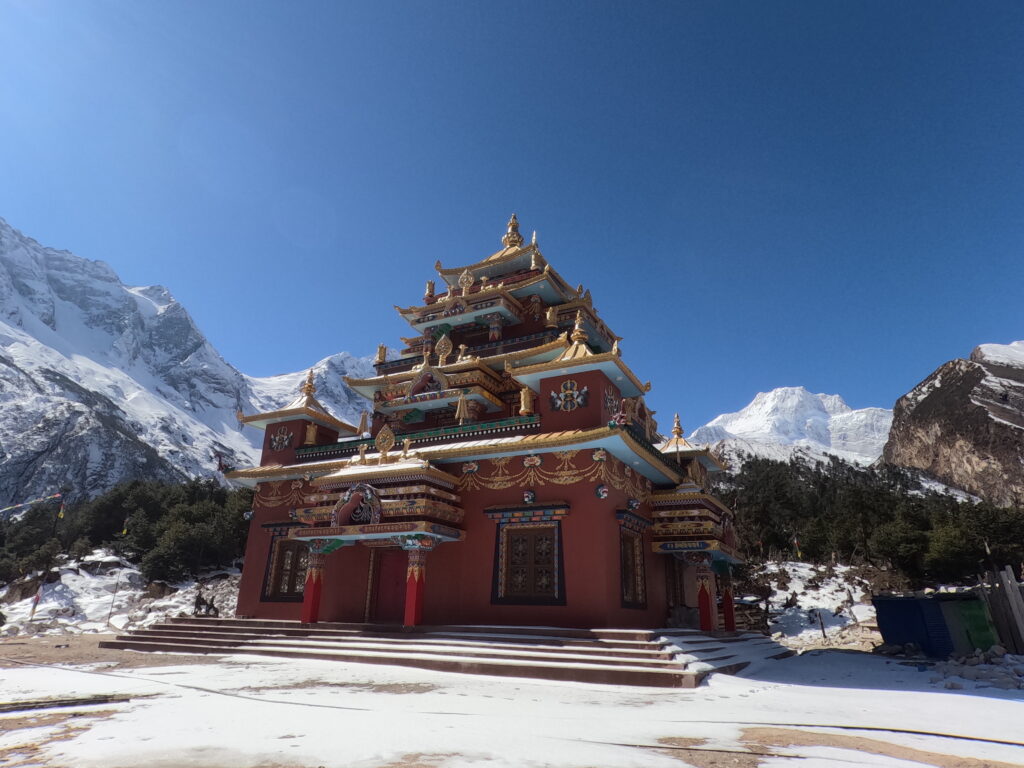
Manaslu Luxury Trek
The Manaslu Luxury Trek offers a unique blend of adventure and comfort, providing trekkers with the opportunity to…
Manaslu Circuit Yoga and Meditation Trek
Introduction The Manaslu Circuit Yoga and Meditation Trek is a very unique experience in joining breathtaking landscapes in…
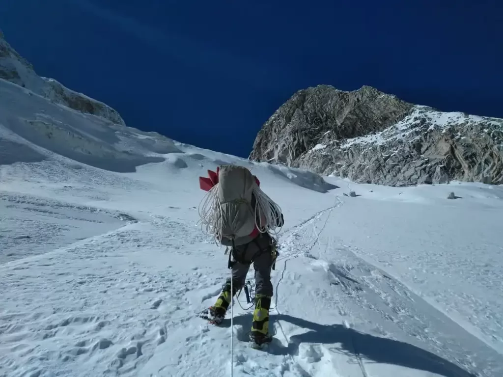
Larkya Peak Climbing – 19 Days
Larkya Peak Climbing offers an exhilarating trekking and climbing experience on Larkya Peak (6,249 meters), located on the…
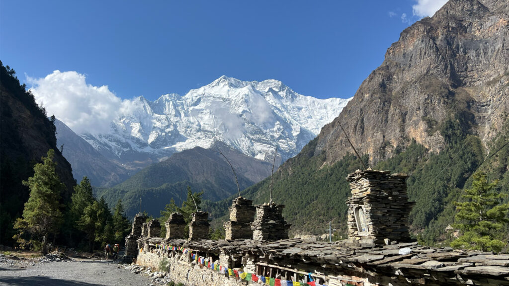
Manaslu and Annapurna Circuit Trek – Ultimate Nepal Circuit Adventure Guide
The Manaslu and Annapurna circuit trek represents one of Nepal’s most extraordinary long-distance Himalayan trek experiences, seamlessly connecting…